Karuah & Stroud Flood Risk Management
Published on 25 October 2017

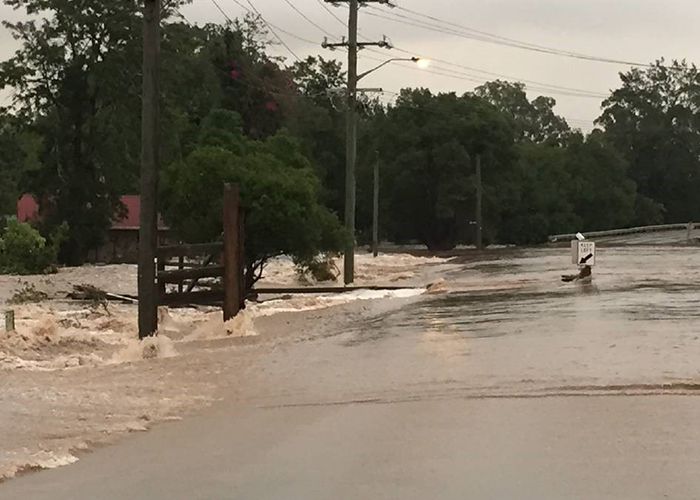
Following the severe flooding at Stroud in April 2015, the team at MidCoast Council is looking to the community to collaborate in developing a plan to manage flooding at Stroud and in the broader Karuah River catchment. This includes the townships and settlements of Karuah North, The Branch, Allworth, Booral and Stroud Road.
A comprehensive Floodplain Risk Management Study will be undertaken over the coming year, with the purpose of identifying and assessing a range of flood risk management measures aimed at reducing the impacts of future flooding on the local community. Up for consideration will be flood modification options (such as levees, channel or bridge works), response modification options (such as emergency response improvements or community awareness activities), and property modification options (such as land use planning changes or voluntary house raising).
MidCoast Council has commissioned engineering consultants Advisian (part of the WorleyParsons Group) to develop the study. It follows on from the Stroud Flood Study completed in 2012 and the Karuah River Flood Study completed in 2010, which determined expected flood conditions for various levels of flood severity.
Roshan Khadka, MidCoast Council’s Coastal and Flooding Engineer explains, “Earlier studies have informed what can be expected in terms of flooding impact in the region, and we’re now looking to develop a suite of options that will guide how we manage the risks associated with floods into the future”.
As part of the study, residents and business owners are encouraged to share their ideas to improve flood management in the region. Options identified through the study will be assessed to understand their potential impacts and benefits, with a final suite of recommended options presented in the Karuah River and Stroud Floodplain Risk Management Plan, expected to be completed by late 2018.
“We’re asking the local community to contribute by completing a questionnaire to highlight their priorities and challenges regarding local flooding and to provide ideas around potential flood management activities. Then, at a later stage they’ll be asked to review a short-list of flood management options by attending community information sessions”, Roshan added.
The questionnaire can be completed online at the following address: www.midcoast.nsw.gov.au/floodstudy
The questionnaire will also be mailed to residents along with a newsletter about the study.
Council will also be forming a Floodplain Risk Management Committee to oversee the study. The committee will be made up of Council representatives and community members. A request for expressions of interest in joining the committee will be circulated in the near future.
This project is supported by the NSW Government’s Floodplain Management Program and is part of MidCoast Council’s commitment to supporting the local community. For more information about the Stroud and Karuah River Floodplain Risk Management Study and plan please visit www.midcoast.nsw.gov.au/floodstudy or email [email protected].